While a hoped-for trip to Low Island didn’t seem like a good idea due to a north wind, we ended up spending the day on the beach north of Shoals Point instead. The beach was protected from the wind, and despite an adventurous landing and departure from the beach, it was a nice day to spend outside.
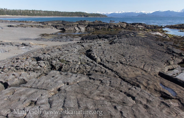
I was interested to note that there was no evidence that I could recognize of glacial smoothing on the rocks there. This was expected, based on past experience, but I hadn’t really looked for that sort of thing specifically before. I don’t know how old the formations are, maybe 10,000 years, maybe longer? However, it seems quite likely that no ice over ran that location since that time.
Bird-wise, it was fairly quiet on the beach. A few shorebirds flew by from time to time. Just as we were getting ready to leave, a small flock of 9 Semipalmated Plovers (first for me this year) came running down the shore in that run and stop pattern they seem to share with robins. Also we saw two Caspian Terns flying along the shore (also first of year for me).
Longer version:
With the weather forecast calling for pretty decent weather, and Rowan’s birthday coming up, I that we would be able to get out to Low Island with Kent Bovee to do some tidepooling and beach combing. Unfortunately, a stiff north breeze that persisted throughout the day made that ill-advised, so instead we wandered around the beach just north of Shoals Point.
Going ashore had an interesting moment when a couple of small waves joined together into a slightly large (but still not big) wave and broke over the stern just as we were nearly to shore. Rowan had just said she didn’t want to get wet, but she took it pretty well as she and I got doused. I hopped out and push the inflatable to shore to keep us out of the next wave. With temperatures in the 60s, bright sun, and the beach largely protected from the wind, wet clothes were not a problem.
Getting back out proved to be even more interesting, as the tide had come up, and as it did, some of the rocks forming a wind break were covered up. In addition, perhaps due differences in the slope of the beach, some of the waves coming in seemed larger. We sent our stuff out on a first trip to the boat, then Connor, Rowan and I waited and watched. There were periods of calm between larger waves, but unfortunately the larger waves came in pretty fast when they came, and were not waves to try and get through in an inflatable raft when they were breaking. We were able to time things good enough, and hop from a rock into the inflatable and make it back to the boat.
Between the interesting arrival and departures, we found plenty of ways to amuse ourselves.
Rowan didn’t end up doing much tidepooling, she seemed a little intimidated by the depth of some of the pools, and wasn’t sure what to do with all the surf grass that was making it hard for her to see. Instead she spent a fair amount of time walking the drift line and picking stuff up. She also had a go at wading and even swimming (sort of) in some of the deep pools where the creek comes down. Connor had found a sizable block of foam that Rowan thought she could hold on to and try to swim with. She was a bit traumatized when it started rolling on her while she was in waist-deep water. Each time she grabbed for it, it would just roll over again, and she stated to panic. In her panic, she forgot it was only waist deep water, so fortunately I was sitting there and could remind her to just stand up. It took her a few minutes to recover from that. After that she tried wading back in, then lunging forward towards the shore and kicking. I also suggested she get down on her knees and practice feeling what it was like to move her hands/arms through the water, and how she could use that to propel herself.
Connor seemed to enjoy exploring around and hanging out with Kent. He found what appeared to be a mink latrine area. The scats were filled with amphipods, which I found a little surprising, as I would have thought it might be hard for a mink to catch enough of those to be worthwhile.
I spent a bit of time looking around on the rocky point at the north end of the beach. There were some interesting looking seaweeds in the tidepools, and quite a few tidepools, some of which were fairly deep. I took a few pictures with my underwater camera – for some of the applications it was mostly guesswork, since I wasn’t inclined to stick my face down in the water to see better (not that it would have worked out very well anyway, without goggles). I did notice a mink running through the crevices of the rock outcrops. I got some good looks at it, but couldn’t get my camera out and ready in time to get pictures. Another thing I thought was pretty interesting were bunches of red velvet mites on top of a high intertidal tide pool. Not sure if they just fell off the rock (though I’m not sure how/why that might happen), or went down there on purpose. In my photos I noticed springtails on the surface as well, though it’s easier for me to imagine they accidentally sprung off the rock and ended up on the water.
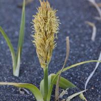
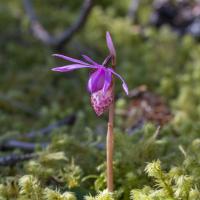
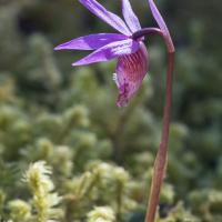
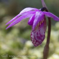
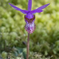
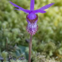
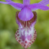
Calypso bulbosa and Carex macrocephala were both blooming. Nice to see those plants that I have not found on the road system.
It’s interesting to speculate about the development of the bluff sort of stabilized dune between the beach and the small stream that flows down. It seems to come out of the uplands around the mid-point of the beach, but then runs to the north behind a high area that I presume is made up entirely of sand, though it’s difficult to say for sure. The creek meets the ocean at the very north end of the beach. The high point of his stabilized area is probably 20 feet or more above the stream (which at that point is still intertidal). 1-2 foot diameter spruce cover it. On the ocean side, there is a lower step that is covered in dune grass and other plants that is getting encroached on by spruce. I didn’t take any pictures of this area, but may have some from past trips (or can try to remember to get some in future trips).
Two questions I have are why the stream goes so far to the north? It’s possible there is rock under the high area that prevents this. The second question is why is it so high? It seems like the spruce could have stabilized it at a lower level. I suppose it’s possible they did, but the sand just kept building up.
